Madaba – the city of mosaics
Madaba, known as the “City of Mosaics”, is 30km south of Amman, along the 5,000-year-old Kings´ Highway. The remains of the oldest known map of Jerusalem and the Holy Land can be found here on the floor of the Greek Orthodox Church of St. George. The mosaic map comprises more than a million pieces of coloured stone and was created in the 6th century.
Near the church is a small building with a number of rooms that are used for explanatory talks for the visiting tour groups. Each room has a large wall hanging display of the mosaic and our guide Mo described in great detail the different parts of the mosaic. It depicts hills and valleys, villages and towns as far as the Nile Delta.
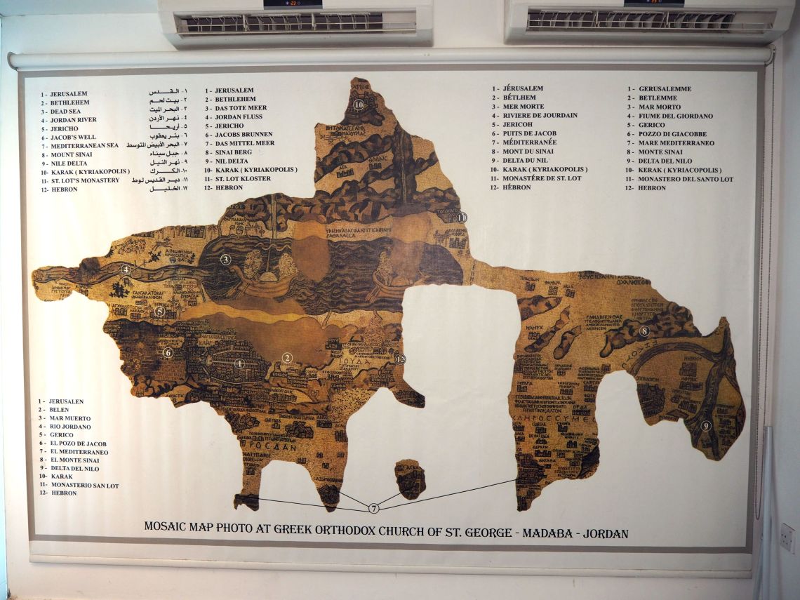
It includes Jericho ringed with palm trees, John’s baptism of Jesus in the Jordan River, a lion pursuing a gazelle and Fish swimming down the river, with one turning back against the flow to avoid the poisonous Dead Sea. There is also two boats crossing the Dead Sea, one being rowed and the other under sail.
Following the talk we entered the church (which was built in 1896 ) to view the mosaic. The original mosaic was around 15.6 x 6m however only about a quarter of it remains. In spite of some inaccuracies, it is regarded as the most exact map of the Holy Land before modern cartography was developed.

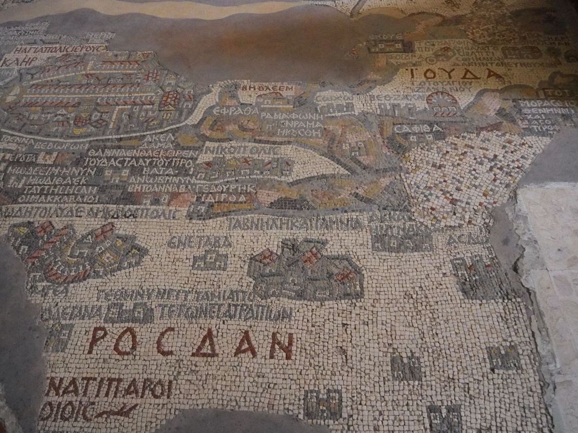
One of the remarkable things about the map is the bird’s-eye view of the “Holy City” of Jerusalem. The city is presented with walls, gates, main streets and 36 specific buildings. The other odd thing about the map is that it is oriented to the east rather than north as in modern maps. As such, the Jordan River which runs north-south is depicted flowing from left to right.

There are a number of other churches in Madaba that contain mosaic remains as well as the Archaeological Park and Museum so if you’re into ancient mosaic art it’s worth a visit to the ‘City of Mosaics’.
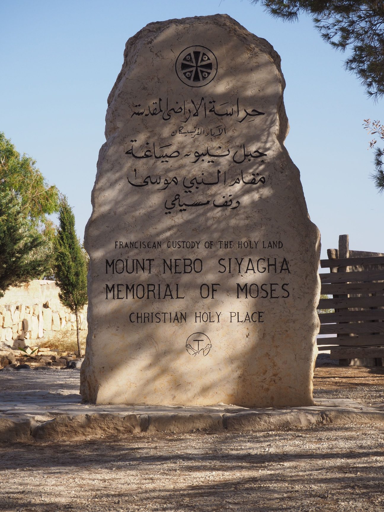
Mount Nebo – viewpoint of the Promised Land

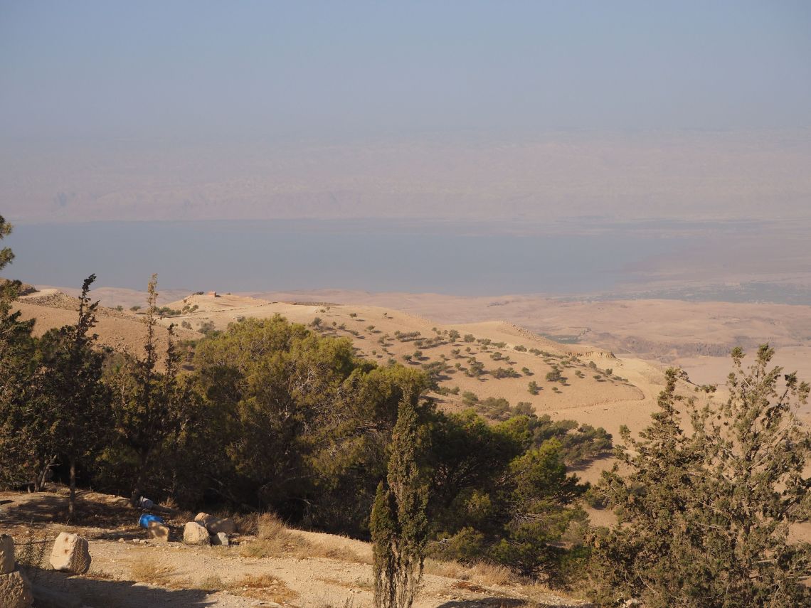
Our tour continued with a visit to Mount Nebo – the mount where, after 40 years of leading the Israelites, Moses viewed the Promised Land. At 820 metres high, it looks down 1220 metres on the nearby Dead Sea (which is about 400 metres below sea level) and the view from the summit provides a panorama of the Holy Land.
The West Bank city of Jericho was just visible through the haze from the summit and apparently on a clear day you can see Bethlehem and the distant hills of Jerusalem. Neither were distinguishable to us on this day.

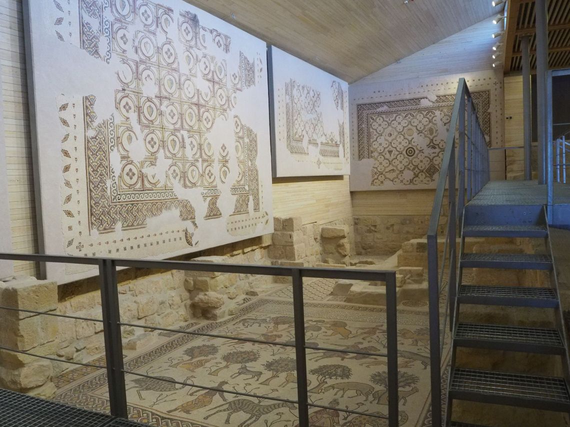
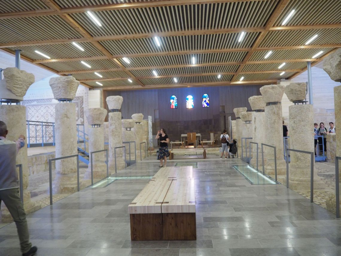
Egyptian monks built a church here in the 3rd or 4th century and it was expanded in the 5th and 6th centuries into a large basilica with a collection of Byzantine mosaics. Though little remains of the early buildings the mosaics are still there so we spent some time viewing these ancient art works.


From Mt Nebo we continued South along the Kings’ Highway stopping at a modern mosaic factory, crossing Jordans Grand Canyon and stopping off at a couple of castles on the way to the highlight of the tour – Petra. That journey will be the focus of our next blog – stay tuned.
